Chimborazo

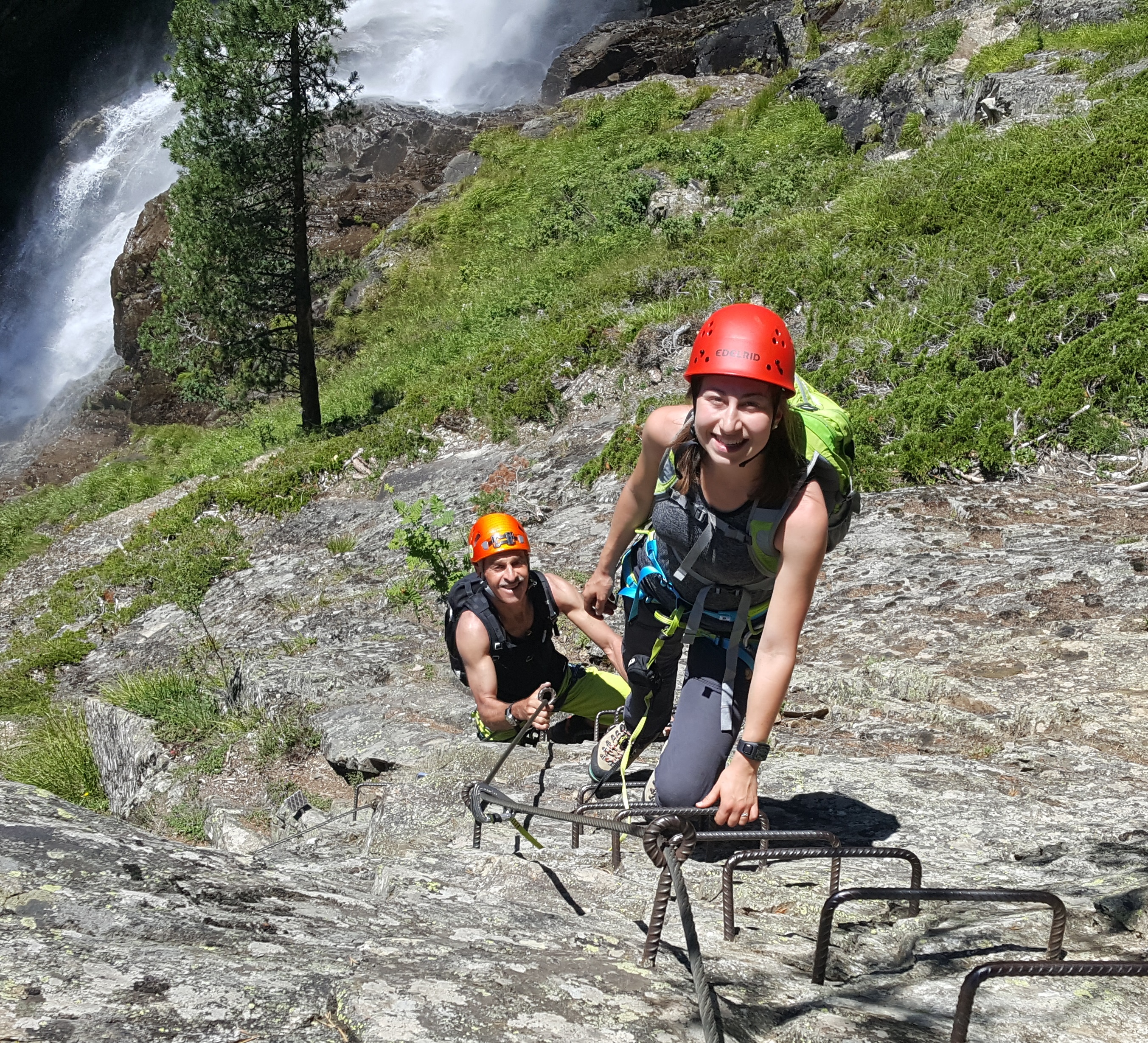
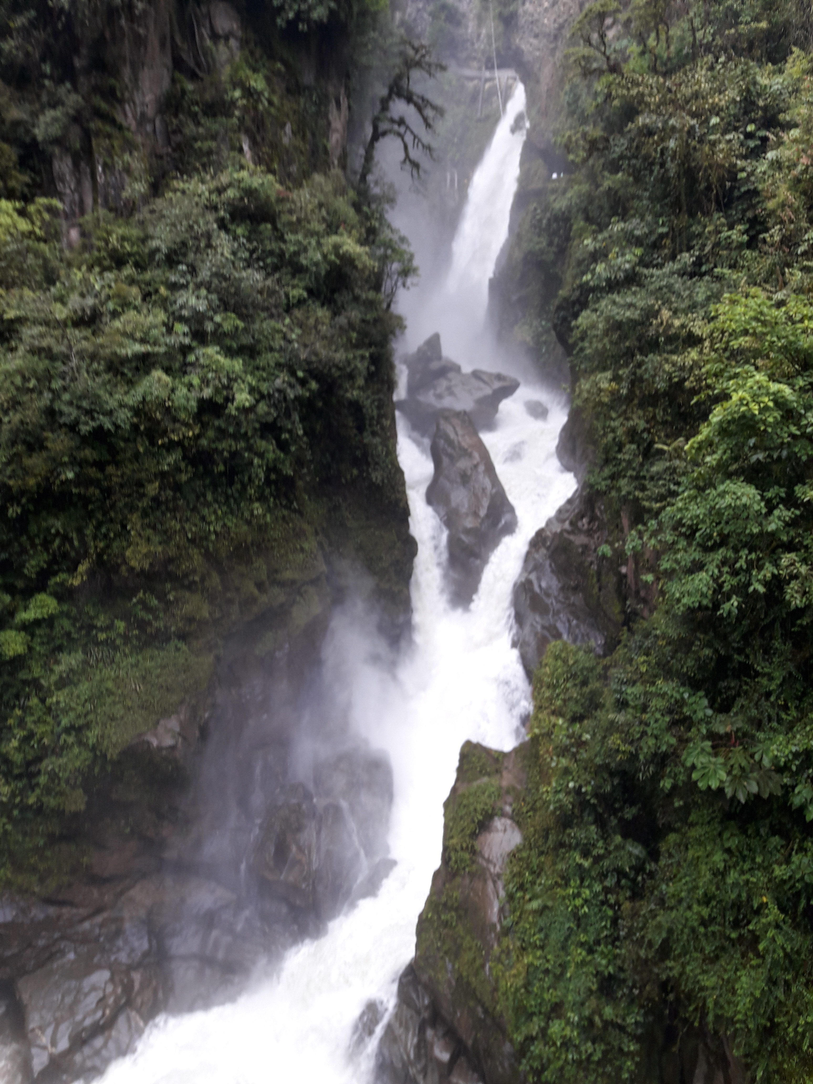
After we had left Parque Nacional Cotopaxi, we drove down to Baños where we went out for dinner. Afterwards Joline and I toured downtown a bit and went to sleep. The next morning we went to the Pailon del Diablo, an enormous water fall in the Ecuadorian jungle. We took the whole morning to see the falls, flowers, humming birds etc.

Pailon de Diablo

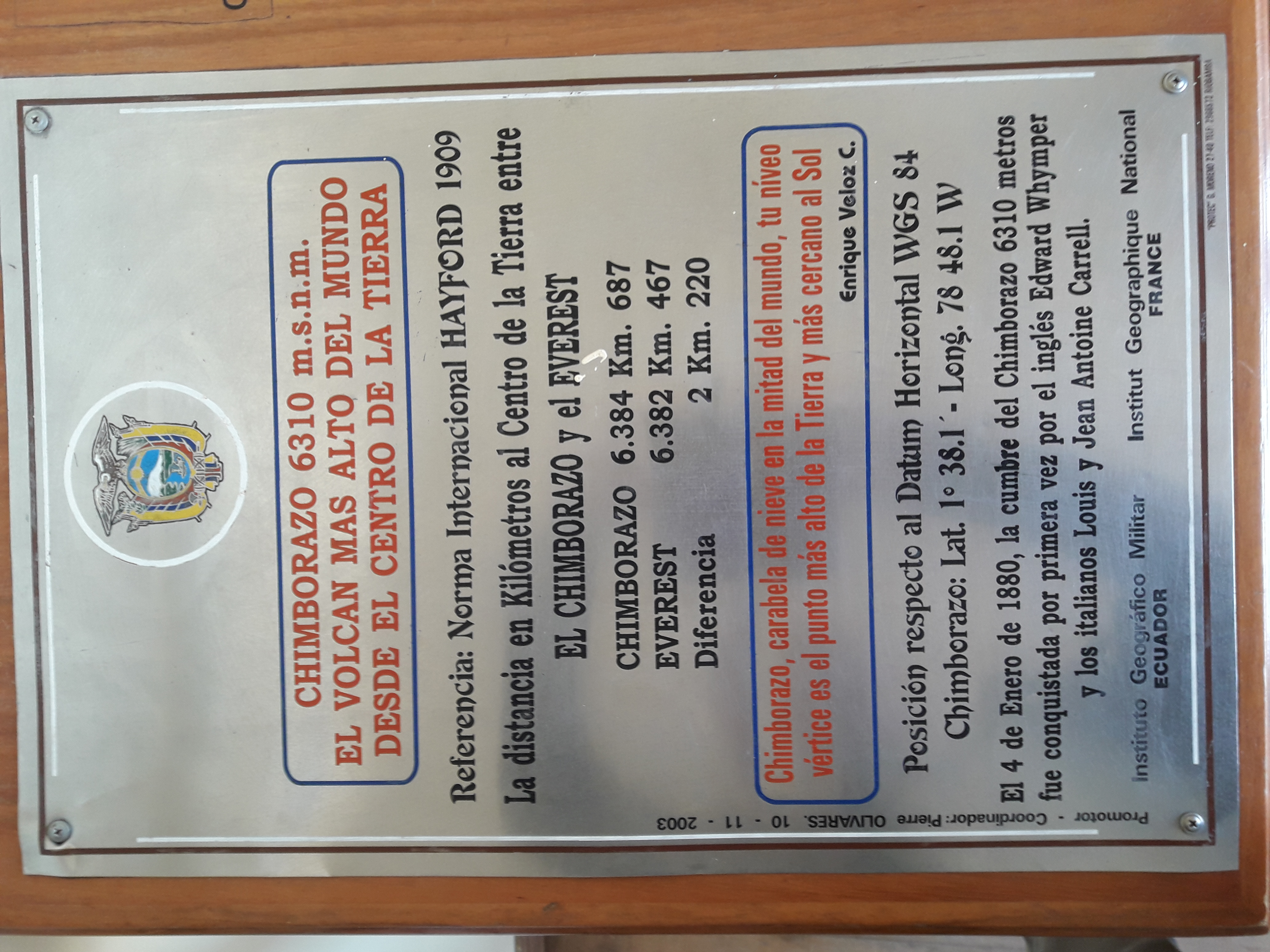
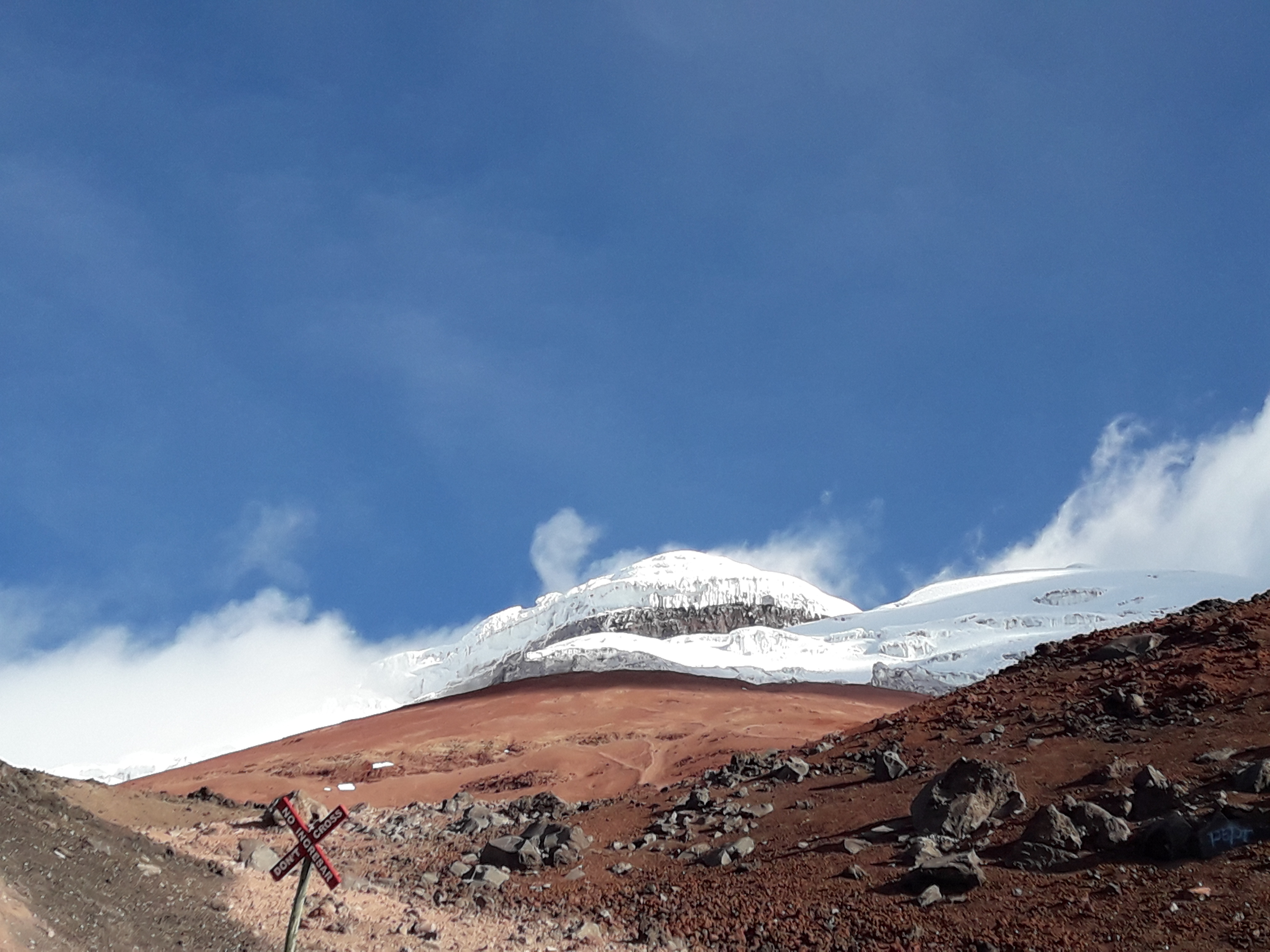
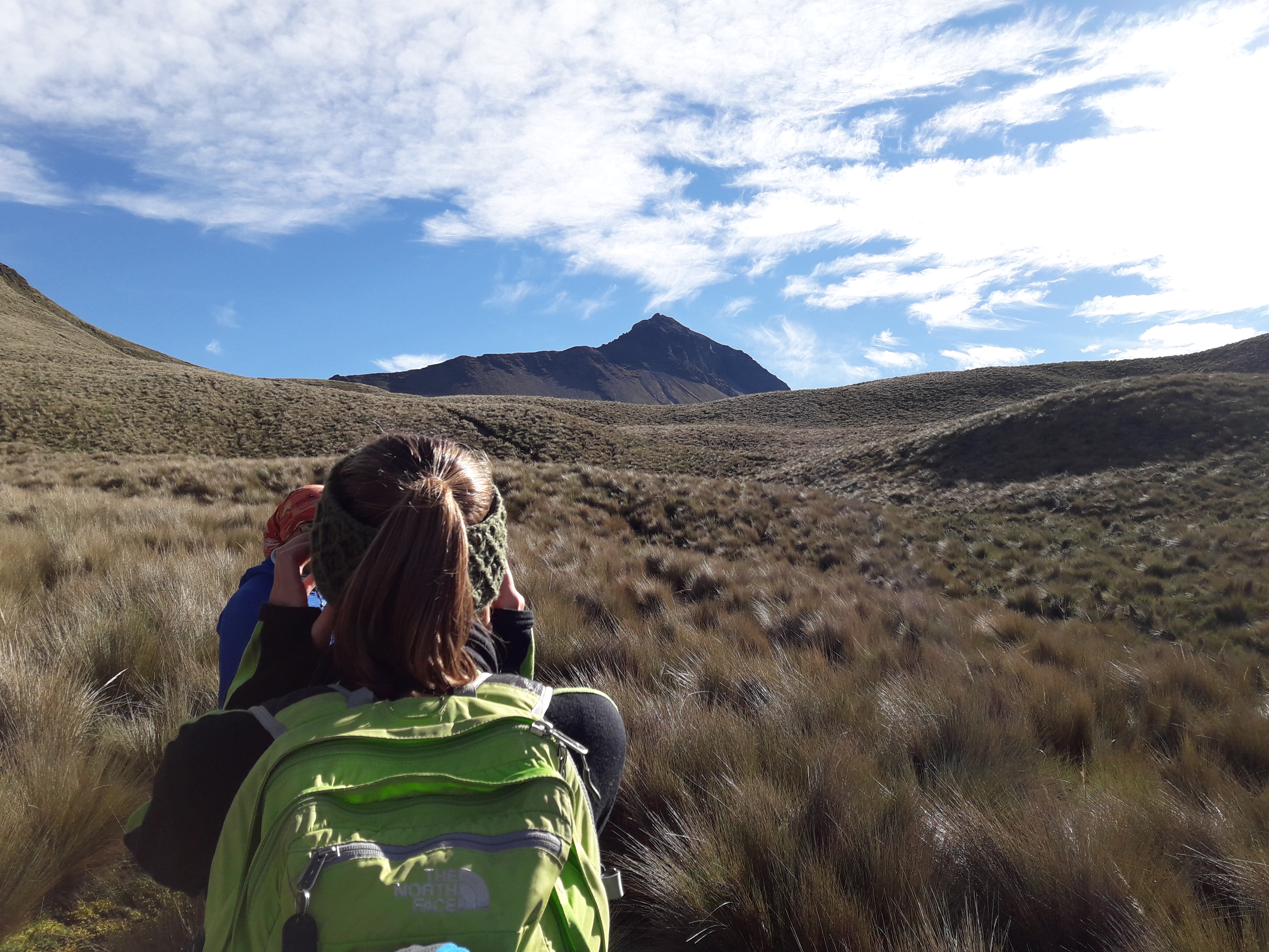
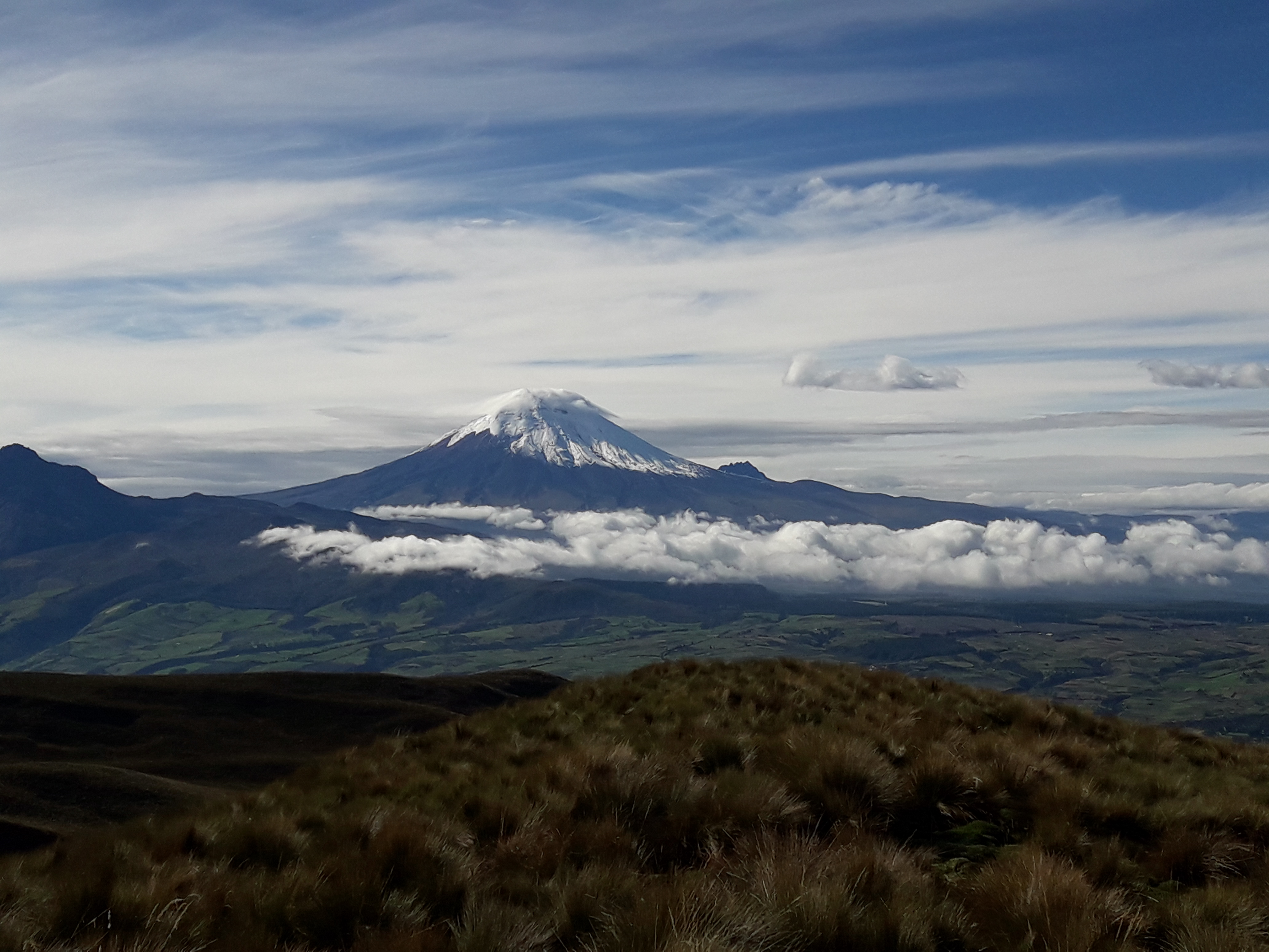
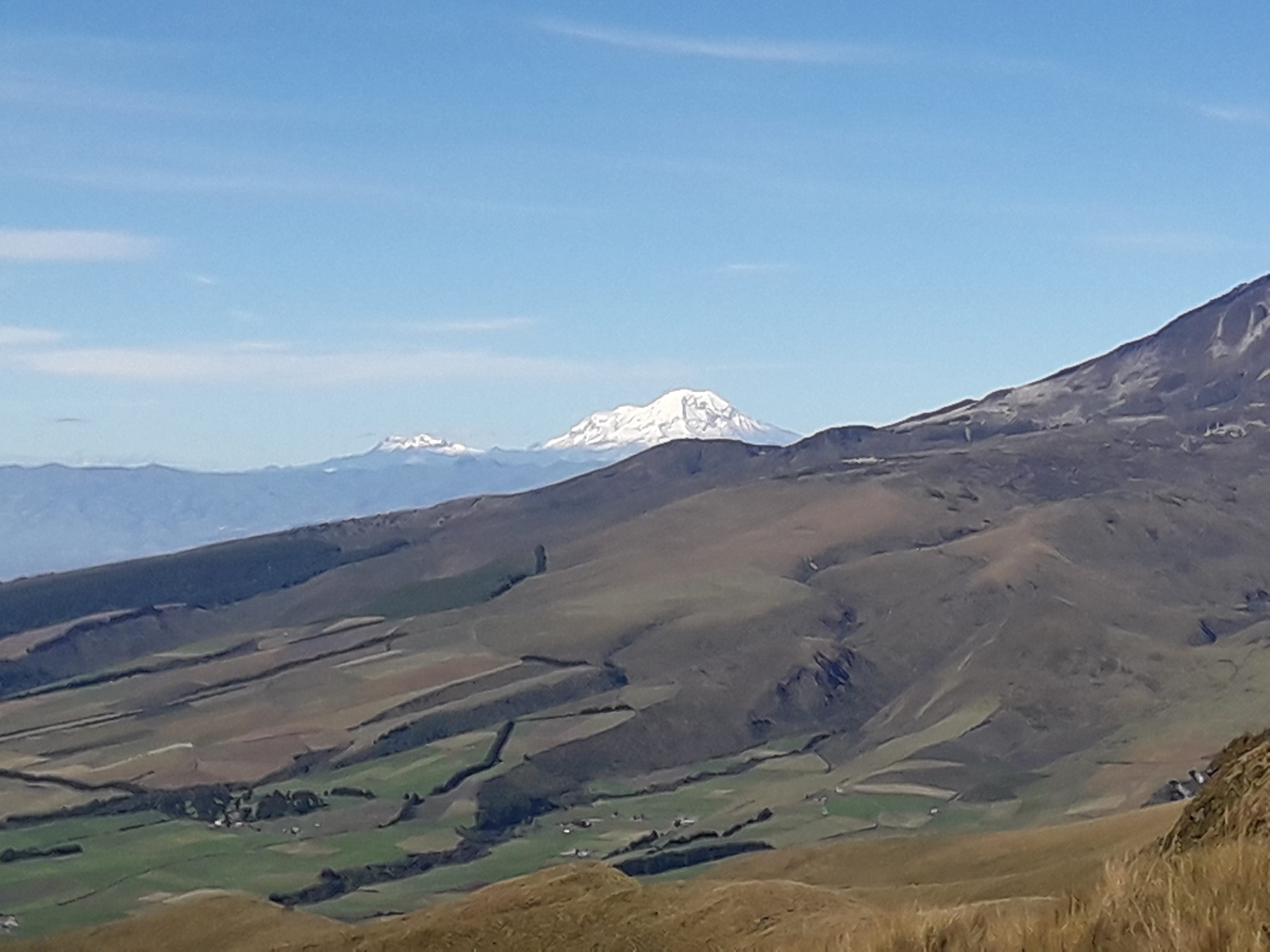
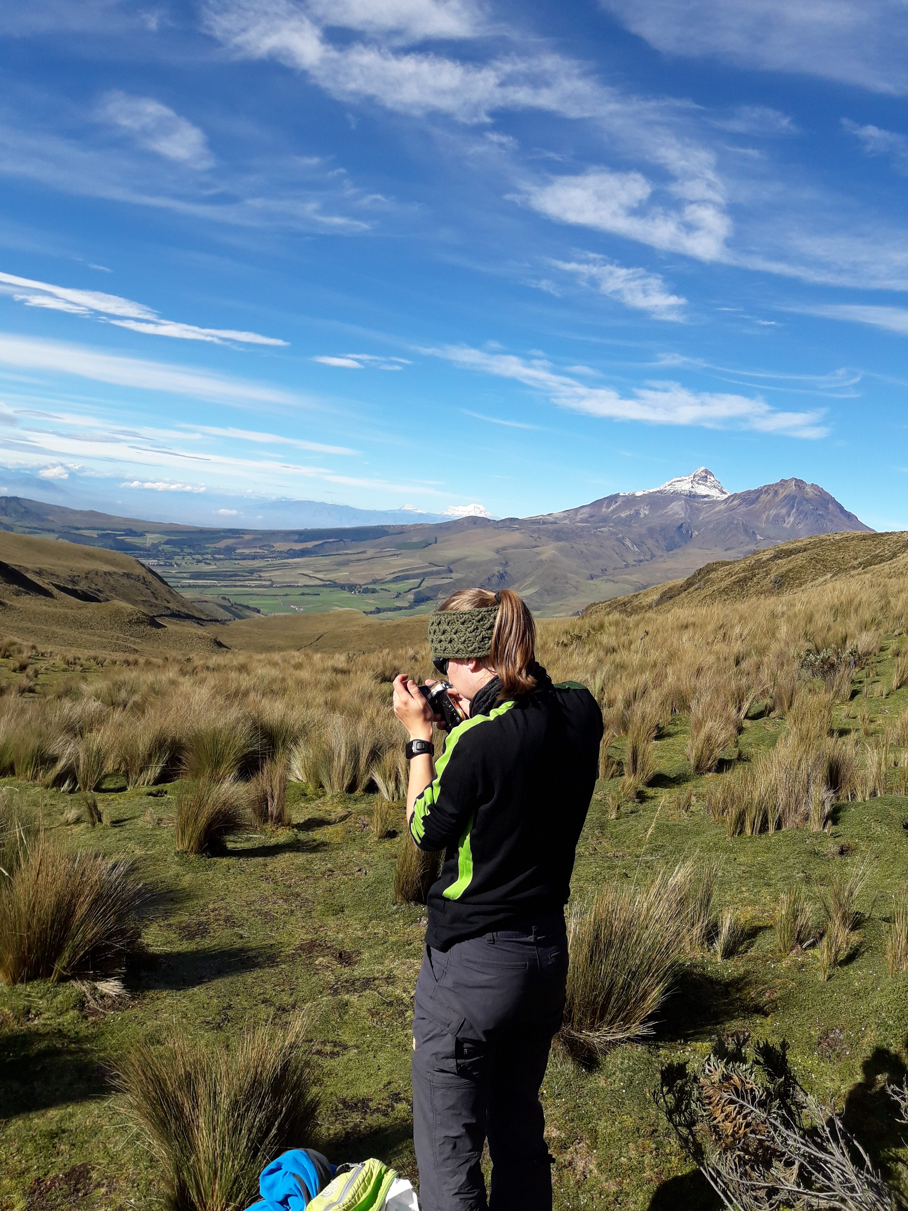
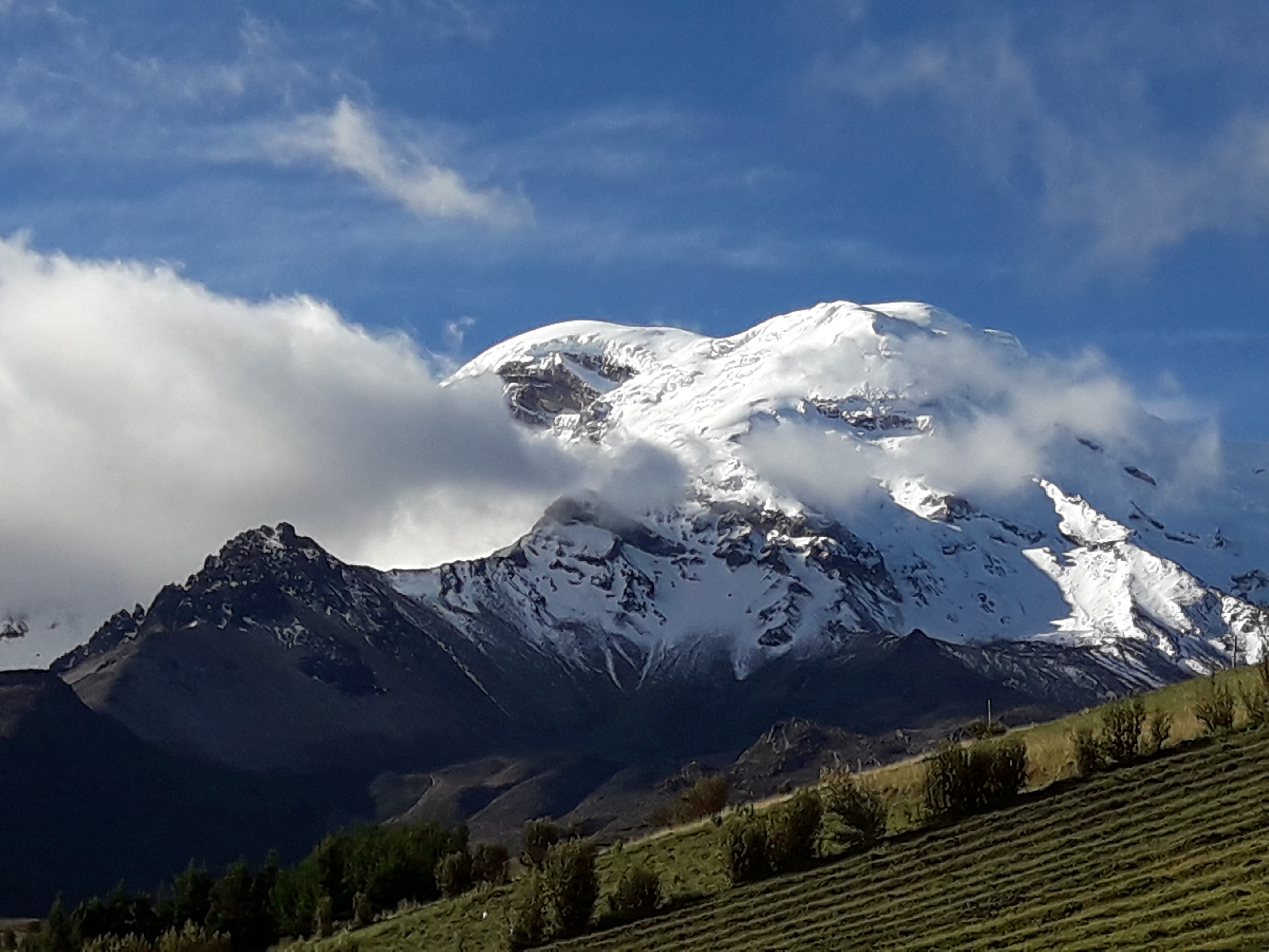
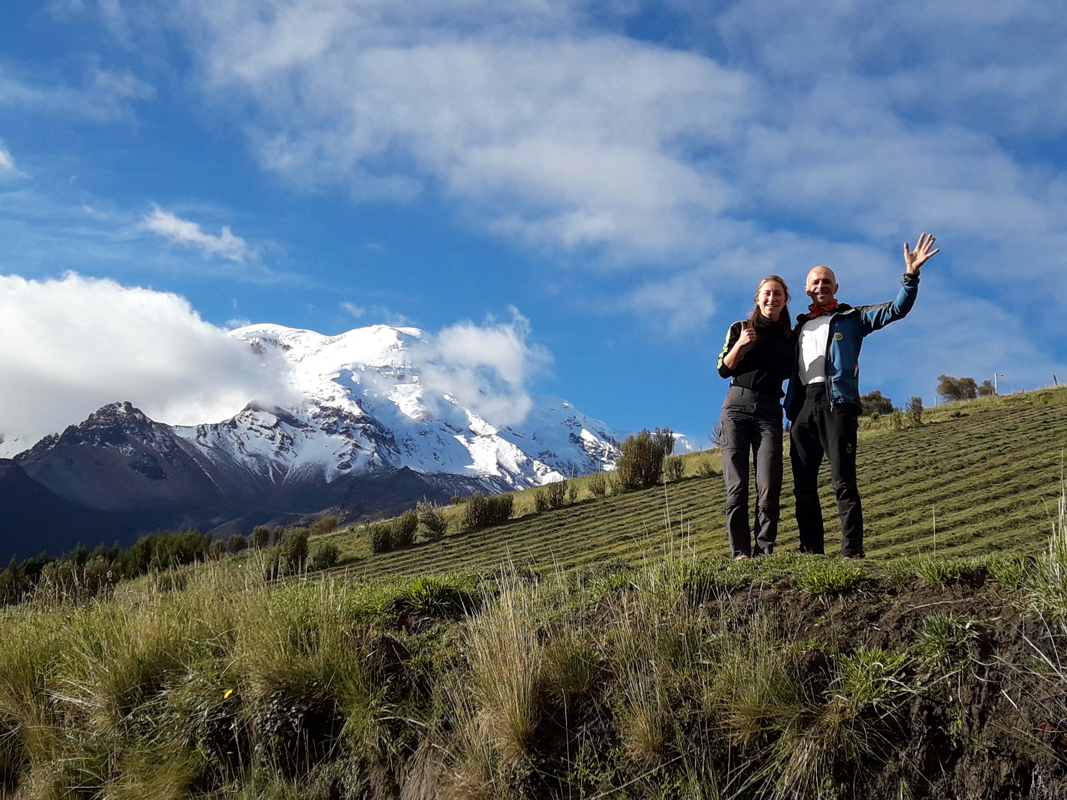
After the Pailon del Diablo, we went back to Baños for lunch and then drove to Reserva Producción de Fauna Chimborazo. On the way we had some beautiful views of the highest mountain of Ecuador and the highest elevation when calculated from the centre of the earth.

Chimborazo (6310 m)
Posing with Joline in front of Chimborazo

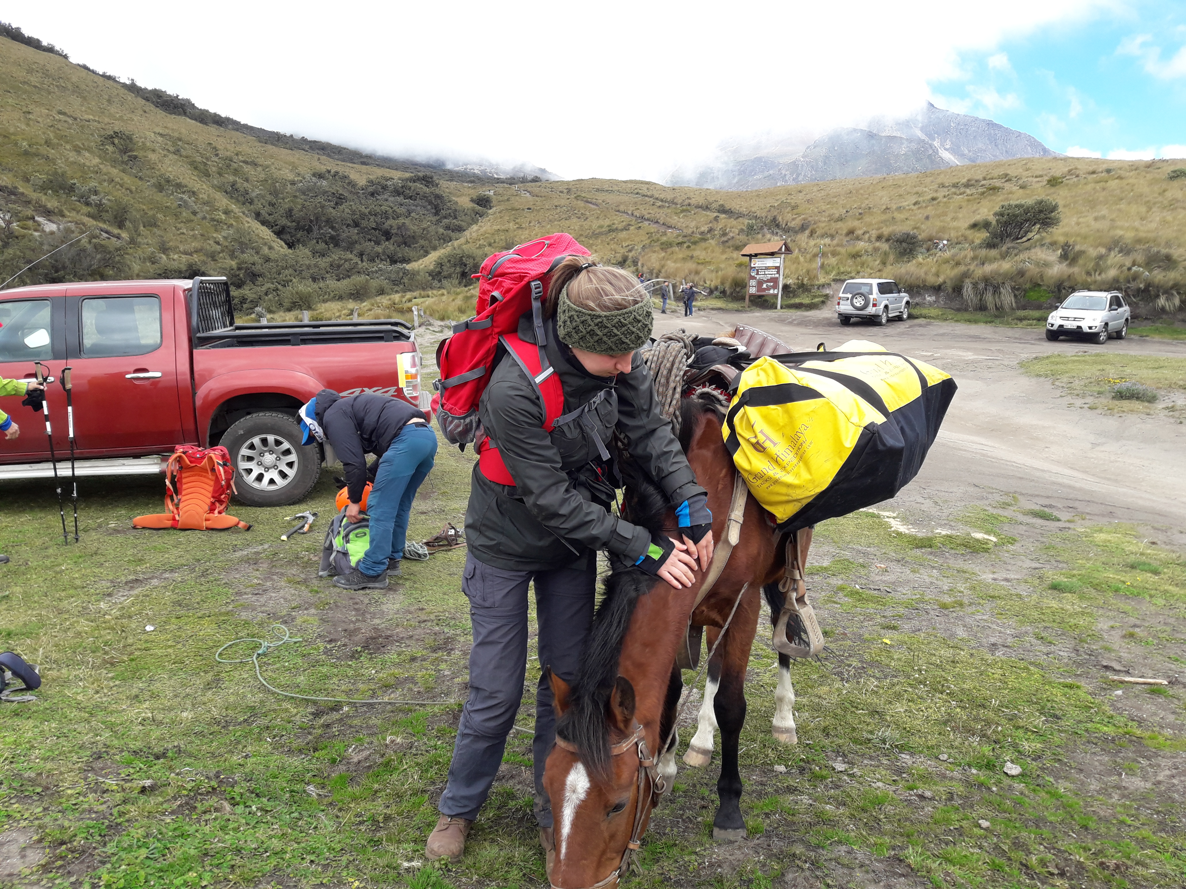
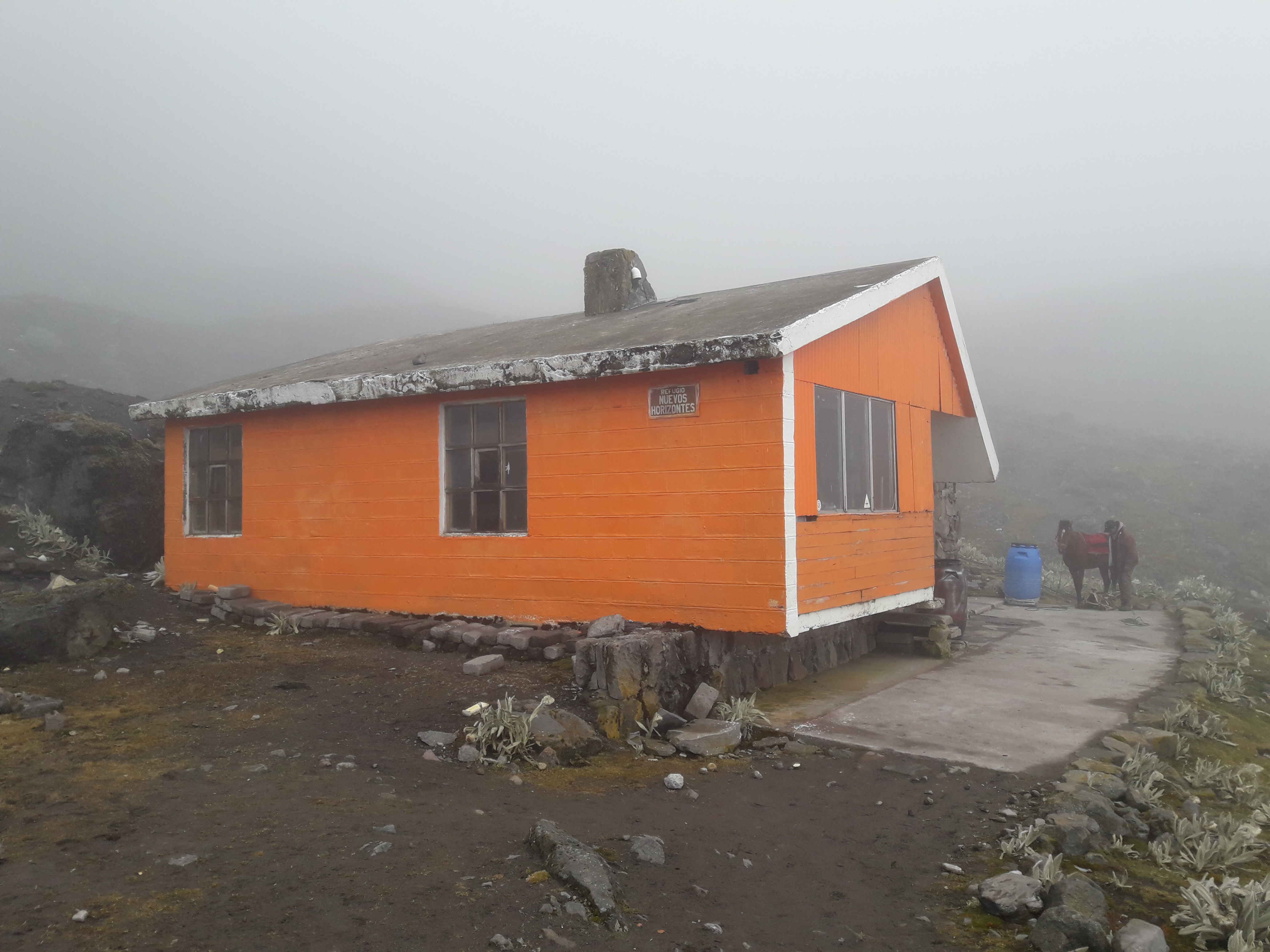
Unfortunately the Whymper hut was closed for climbers, so we had to stay in the lower Refugio Carrel (4850 m) and as a consequence have a longer climb up Chimborazo. After dinner, we went to bed immediately as we planned to get up at 22 h and start the climb at 23 h. We set out at 23 h with perfect weather: clear, not too cold and very little wind. We progressed steadily to the Castello, a protruding rock formation on the west slope but then Joline slowed down considerably. Edgar was worried she would not make it and at 5600 m we decided to go down.

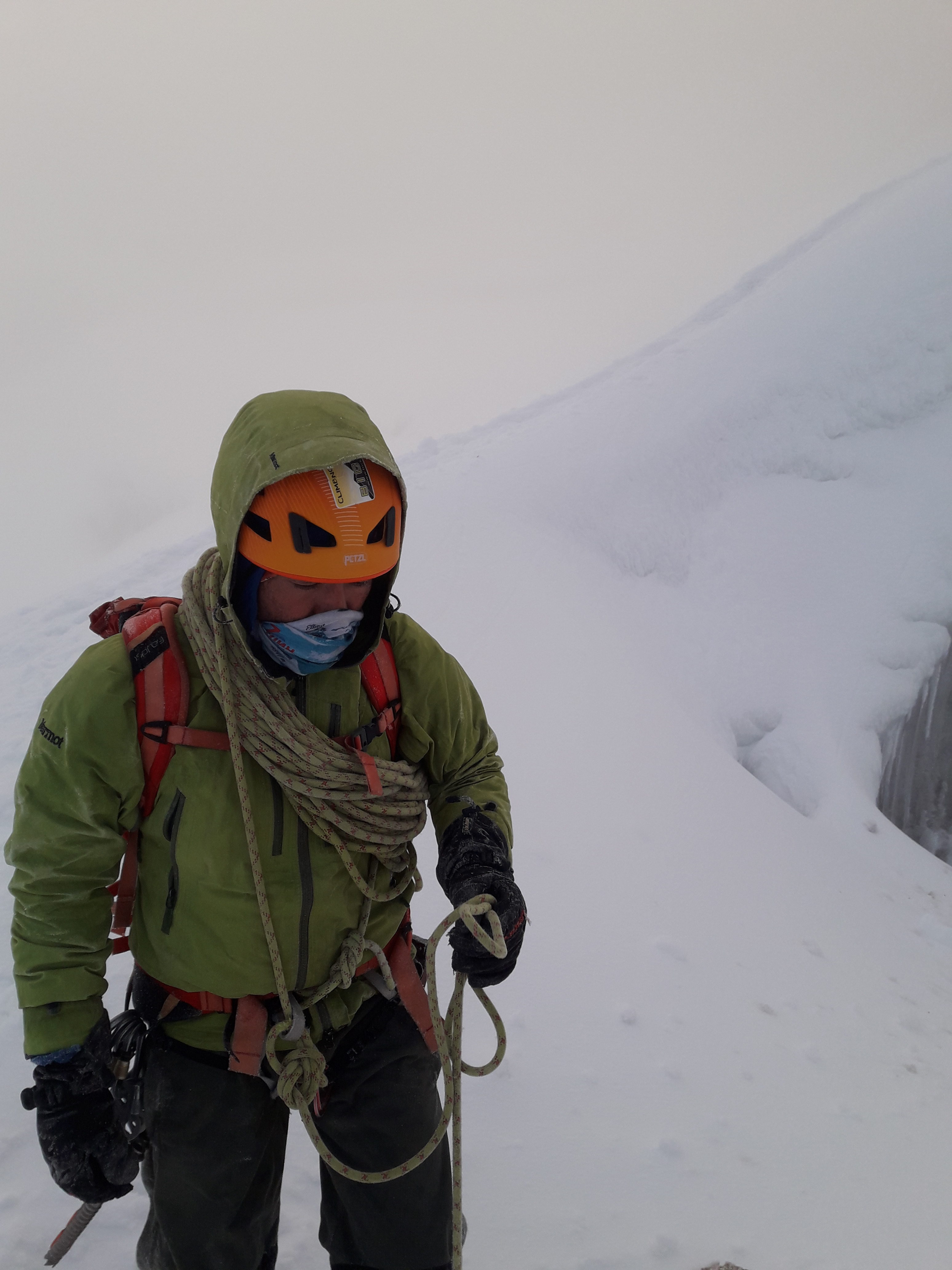
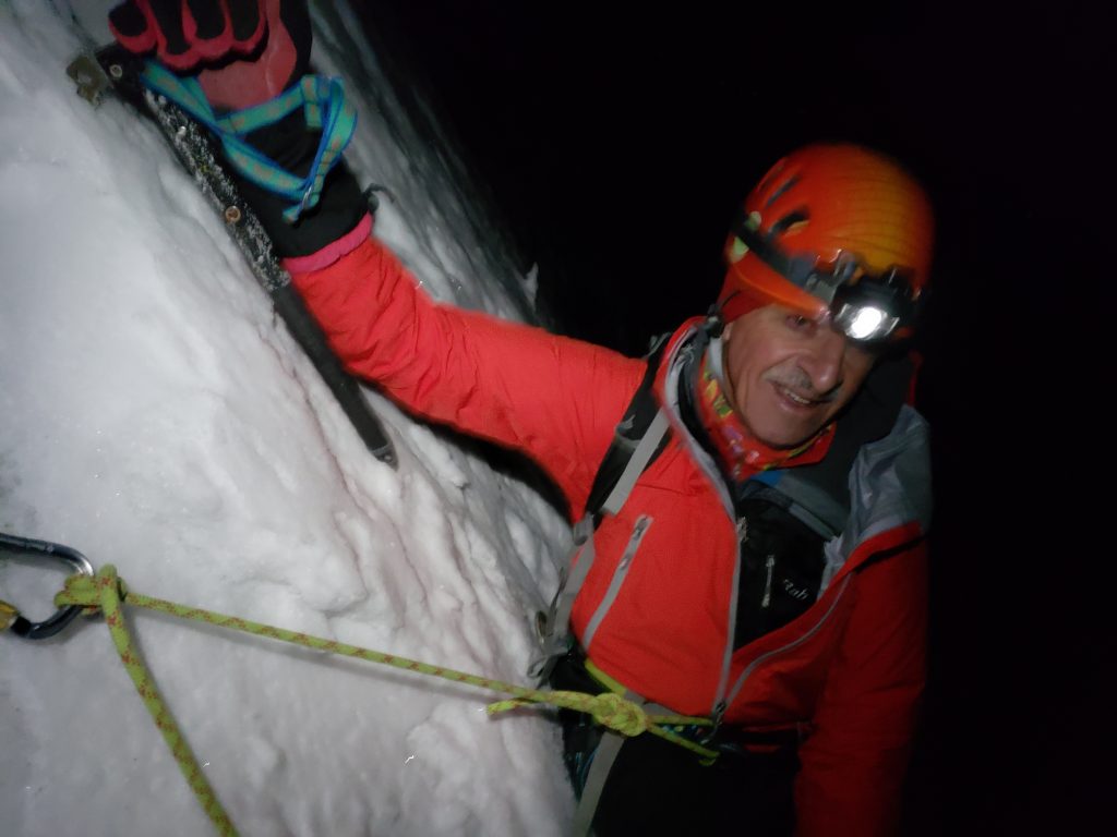
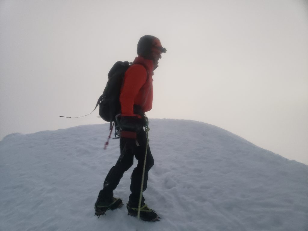
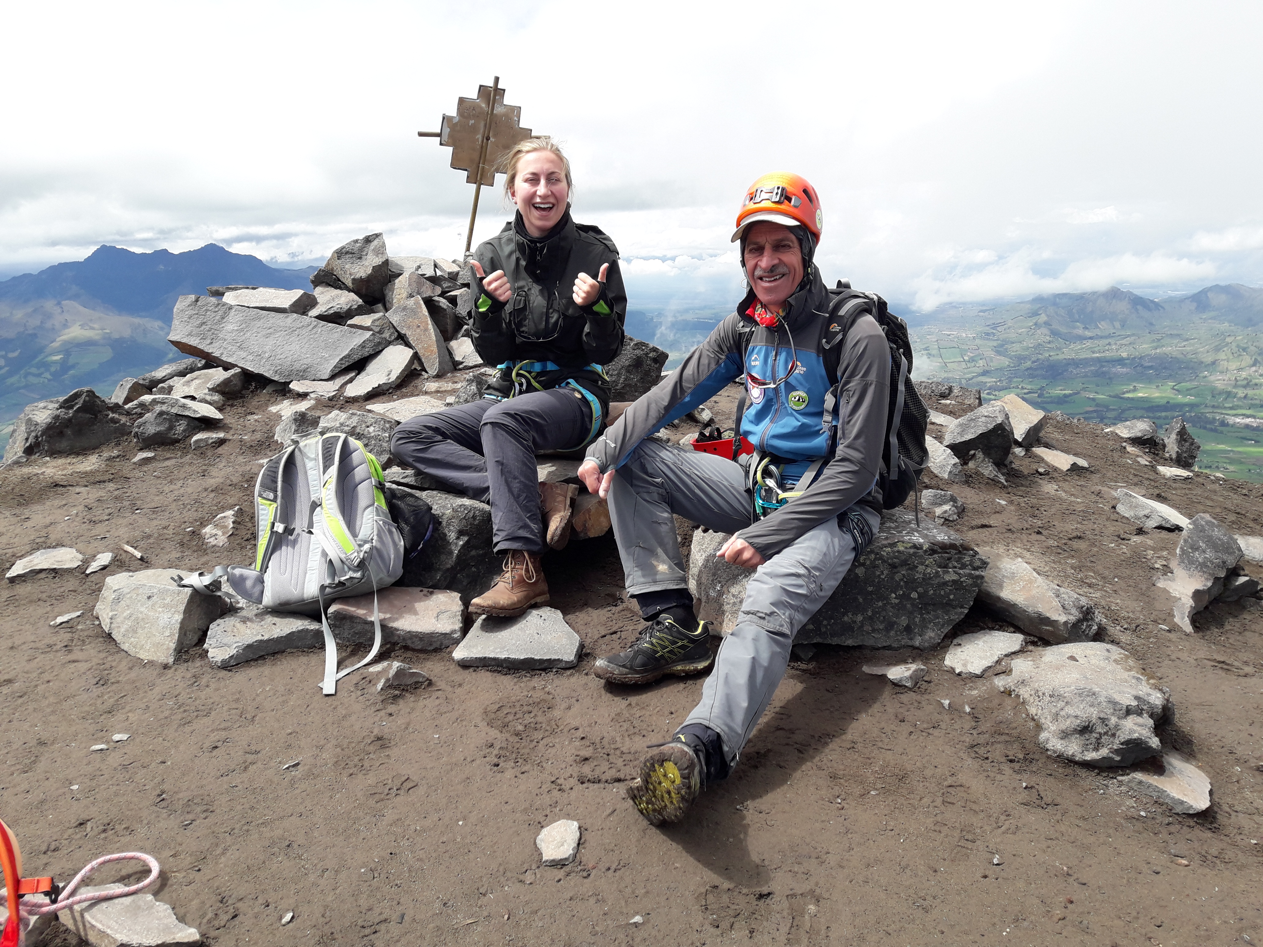
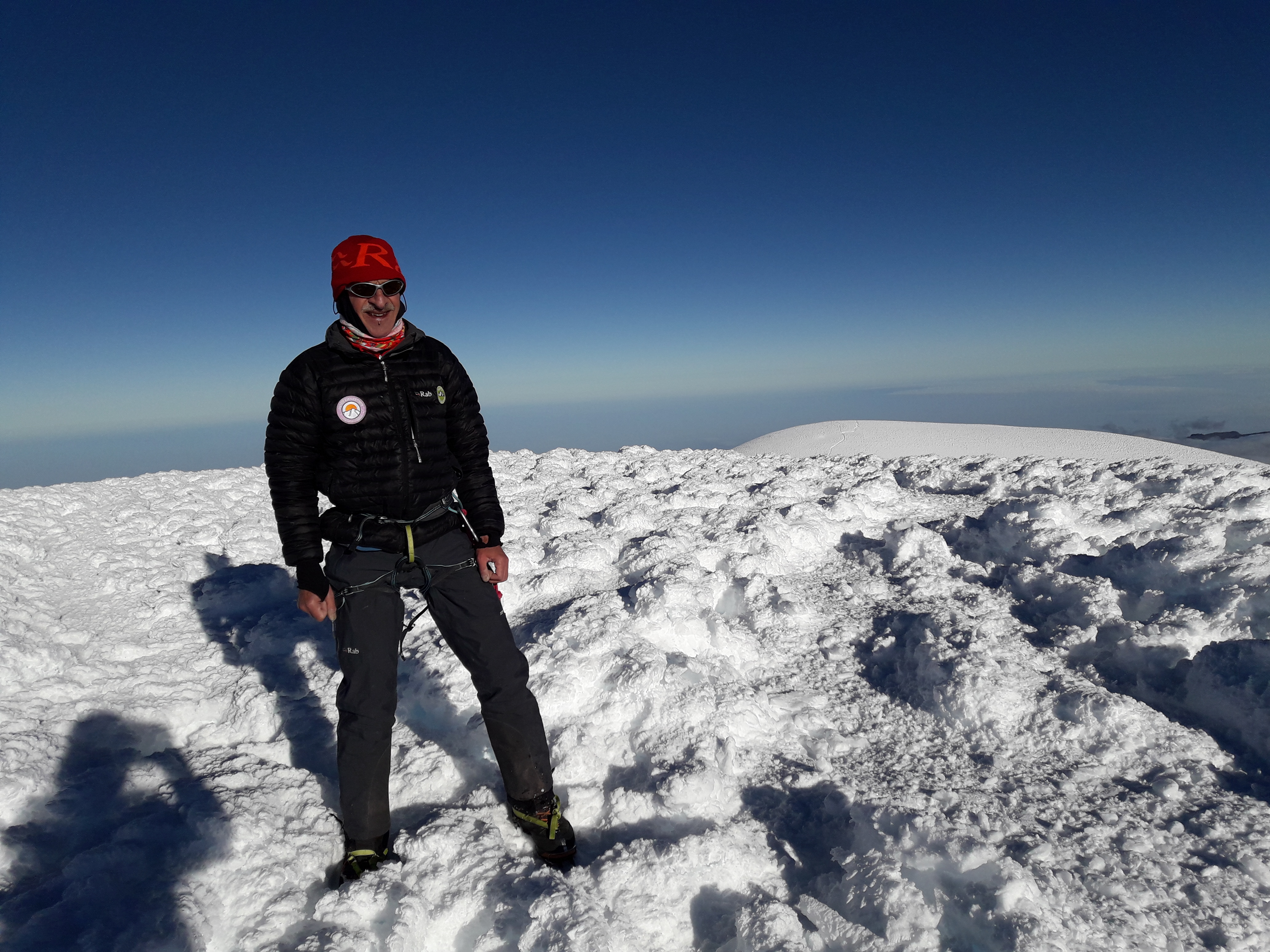
The next morning, Edgar drove Joline and Galina down to Riobamba where they would already go to the hotel and do some sight seeing whilst I stayed at the Rifugio Carrel and tried to rest a bit. Edgar returned end of the afternoon, we had dinner ans went to bed as the day before. At 22 h we rose and we left at 22:45 h as planned for a second attempt of Chimborazo. The weather was slightly worse than the day before with more wind, but otherwise very good. We progressed again steadily, but then the 700 m steep snow and ice slope was very hard. At the end I felt like a zombie and had to use all my internal psychology to keep climbing. We arrived at the Veintimilla summit (6267 m) just after sunrise. After a short stop we continued to the Whymper summit (6310 m), the highest point on the globe when calculated from the centre of the Earth.

At the summit of Chimborazo (6310 m)

After a short pauze, Edgar and I climbed the 1460 m down, of which almost 1000 m steep snowy slopes, to the refuge which was quite horrendous. I was totally exhausted when we arrived at the Rifugio Carrel. We had lunch at the hut, packed our stuff and drove down to join the ladies.

No Cotopaxi

Yesterday we left Rocio’s “Puerta al Corazon”. The night before Rocio had prepared cuy for us. Cuy is a local dish of Guinea pig and probably an acquired taste.

The guinea pic for “cuy” before….


The Guinea pic for “cuy” after roasting…

We first drove downtown Machachi to leave most of our luggage at Edgar’s house and then to Parque Nacional Cotopaxi. Edgar arranged our permits and we drove about three quarters of an hour on bumpy roads to the parking place from where we hiked in about an hour to the Rifugio Jose Ribas.

Edgar arranging the climbing permits for Cotopaxi
Cotopaxi seen from Rifugio Jose Ribas

The Rifugio Jose Ribas is quite popular as Cotopaxi, either to view or to climb seems to attract a lot of people from all over the world. We had lunch and talked to several people visiting before we went to sleep as we had to go up at 23 h. We got up at 23 h indeed and prepared and left at 24 h for the climb. Although in the afternoon the conditions loked very nice and favourable, the weather at night was very different. There was a very strong wind with gusts that made it difficult to keep standing. It was only about -10 °C but with the wind chill factor it felt like -25/30 °C. We struggled for quite a while but got colder and colder with little prospect of the wind getting any less. We were covered in ice and since the route is such that there we couldn’t expect it to get any better, we decided at 2:30 h to turn around…. Once back in the hut, we slept until the morning, packed our stuff and drove back to Machachi. We collected our luggage and drove down to Banos. Tomorrow we intend to go to Rifugio Carrel to climb Chimborazo.

Illiniza Sur

Yesterday we had a relatively quiet day with as only goal getting to the Refugio Nuevos Horizontes. Edgar picked us up at 10 and, following his advice, we had rented a horse to carry the mountaineering equipment to the hut. So we could slowly walk up to the hut at 4750 m.

Joline with the horse that carried our equipment up.

The Refugio Nuevos Horizontes represents the original concept of a mountain hut: a space with a couple of bunk beds, a place to cook and a table with a bench.

Refugio Nuevos Horizontes

Unfortunately, both Joline and myself have caught some throat infection (probably some bugs at the plane or so) and are not entirely fit. We had decided to go for Illiniza Sur, which in my view is way more interesting than Illiniza Norte, which is ~100 m lower, has no glaciers but nevertheless attracts >95% of all climbs. To make sure that all glaciers, snow bridges etc. are well frozen you typically make an early start. We decided to go for 2 h. When we woke up at 1 h, Joline was a bit feverish and didn’t feel well. Edgar and myself decided therefore to go together and Edgar graciously offered to take Joline to the Illiniza Norte later as we expected to be back around breakfast.

We set out at 2 h and had a wonderful climb. Until about 4 h is was clear with some moon shine and we climbed the long, steep (up to 60°) snow walls so efficiently that we were about 30-40 min from the summit at 4:30 h and would arrive at the summit well before sunrise. We decided to have a long break and had a nice conversation at high level (literally, it was at ~ 5100 m) with a spectacular view. Unfortunately, it became very cloudy and when we reached the summit at 5263 m around 6 h, it was covered in a cloud. At -12 °C that means we were soon covered in a thick layer of ice. We climbed down and were back in the refuge ~ 7:30 h. Joline would rather go back to the cottage than climb Illiniza Norte as she still didn’t feel very well.

Edgar at the glacier of Illiniza Sur
Taking a rest, hanging from the ice wall of Illiniza Sur
Summit of Illiniza Sur – hazy weather…

Acclimatisation

Yesterday we left Quito and drove southward direction Pasochao. In some small village Edgar’s brother showed up and took our duffel-bags to drop them off in the cottage where we would stay later. We drove over a cobble stone road with more holes than stones for about an hour to an old hacienda at ~ 3500 m, where we parked the car and started our ascend of Pasochoa.

Pasochoa

Joline and I at the summit of Pasochoa

It took us a little less than 6 h to climb to the summit at 4230 m. After we had climbed down, we drove again for one and a half hour over very bumpy roads (you really need 4-wheel drive here) to the Cottage “Puerta al Corazon” where Rosia, the owner, welcomed us. She didn’t speak English, but reasonable French. Apart from two Americans there were about a dozen French climbers, preparing for Cotopaxi.

Today (July 3rd) we got up at 6 h, got a nice breakfast and Edgar picked us up at 7 h for another drive over bumpy roads. We learned that some of these roads where actually build 600-800 year ago by the Incas (and apparently lacked all maintenance since). After about an hour we arrived at the trailhead just below 4000 m. We had some marvellous views at the Cotopaxi, but also at both Illinizas (actually Corazon is located in the Illiniza Ecological Reserve) and our first glimpse of Chimborazo.

Joline takes a shot of our goal for today: Corazon

Cotopaxi

First glimpse of Chimborazo

Joline takes a photo of Cotopaxi – at the right the Illiniza Sur (snowy summit) and Illiniza Norte (far right)

We had a strenuous climb where we needed ropes to belay ourselves at about 4600 m to reach the summit at 4790 m in just over three hours. This made Edgar very happy as he told us that with most of his clients it takes  easily 5 or even 6 h to reach the summit. It seemed to confirm his opinion that we would be very well up to climb Illiniza Sur (which requires some steep ice climbing). Edgar and myself are very much inclined to opt for the Illiniza Sur which is rarely climbed as >95% of all people climb the Illiniza Norte, which is only about 100 m lower, but has no glaciers, snow or ice.

At the summit of Corazon (4790 m)

Tourist tour Quito

Yesterday we arrived, after a luckily very uneventful flight, in Quito on time. Edgar Parra, our guide, was already waiting for us and brought us to our hotel, where we got a room with a perfect view on old Quito.

View from the Hilton Colon Quit

Today we did a bit of sightseeing of Quito and Mitad del Mundo (the middle of the earth, i.e. the equator line). We first visited the hill with the largest aluminium statue in the world that towers on a small mountain over the old town of Quito. The weather was very nice and we even could see a glimpse of the snowy Cotopaxi.

Posing in front of the Virgin of Quito

View to the South – first view of Cotopaxi, which we hope to climb next week

We had lunch in a nice little restaurant “El Cratero” literally located on the rim of a gigantic vulcano crater, allegedly the only crater in the world with villages inside the crater. From there we moved to Mitad del Mundo, where we visited two musea that both claim to be located exactly on the equator. The oldest (and most famous) one, that is pictured in all tourist guide, however, was a couple of years ago with modern GPS measurements proven to be a few hundred meters off…

Joline and myself on the equator, i.e. the zero-meridian

In the new museum they had a series of fascinating small experiments to show the effect of being exactly on the equator. For instance they showed in a little basin that, when placed exactly on the equator, there was no vortex when the water was drained, but just moving it two meters on the northern hemisphere caused a nice left-turning vortex and when then moved two meters on the southern hemisphere a nice right-turning vortex.

Edgar Parra, our guide, trying to put an egg on a nail at the equator line (that’s supposed to be easy…)

Ecuadorian vulcanoes

This summer, my daughter Joline and I will climb a series of vulcanoes in Ecuador, including Chimborazo and Cotopaxi.

Chimborazo is not only the highest peak of Ecuador, but also the world’s highest mountain if you calculate from the centre of earth. It is also known as the spot on earth closest to the moon 🙂 .

We hope to keep you up-to-date through this website during our expedition. More information on our plans can be found on the menu on this site under “Ecuadorian vulcanoes 2018”

Joline and I climbing the klettersteig at the Lehner Wasserfall in Austria