The planned route to follow on the Dutch Everest 2016 Expedition is essentially the same as for the Dutch Everest 2015 Expedition. On that page more information on the various routes can be found.
Like in 2015, we will attempt the climb via the Northeast ridge. This route is usually referred to as The Mallory Route since this approach to the mountain was discovered by George Mallory during the 1921 British Reconnaissance Expedition. Mallory disappeared with Andrew Irvine from the ridge after a summit attempt in 1924. Whether the pair reached the summit is an enduring mystery. A plaquette in Base Camp remembers their attempt.
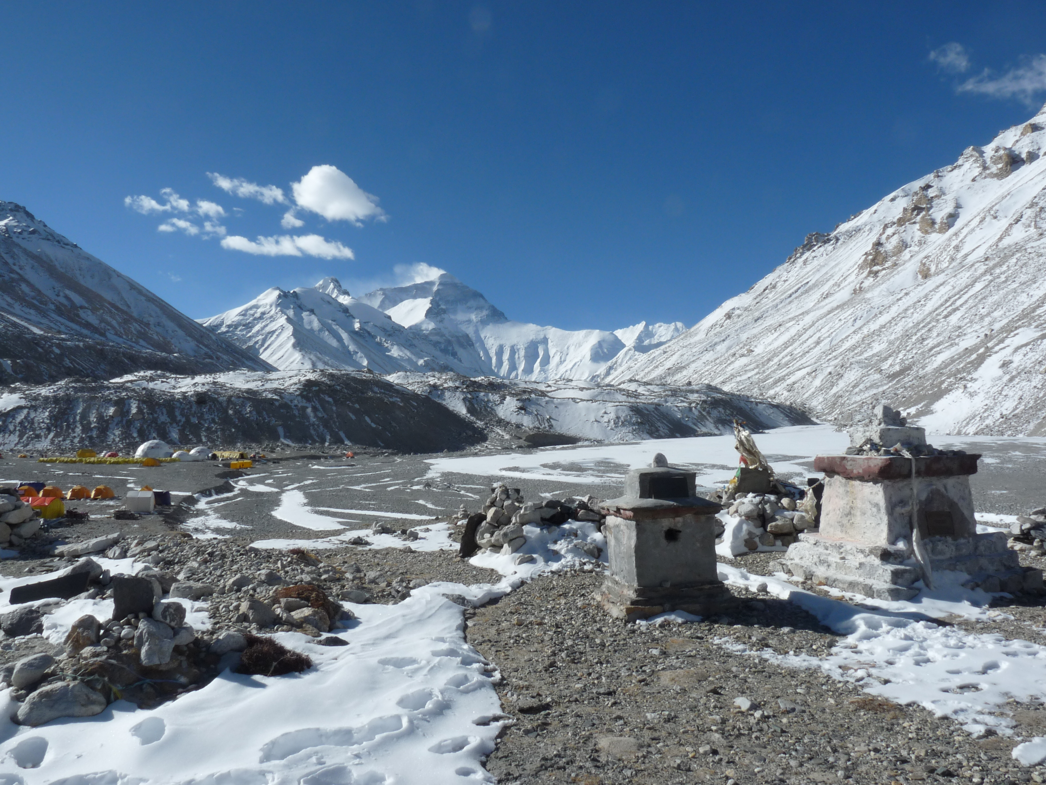
View on Everest from Base Camp (Rongbuk Glacier) with in the front several monuments, including one erected to honour George Mallory (photo taken during the 2015 Dutch Everest Expedition).
Later, on 25 May 1960, the Northeast ridge route was successfully climbed by Qu Yin-Hau (China), Wang Fu-zhou (China), and Nawang Gombu (Tibet). They were officially recognized as the first climbers to scale Everest from North side. The Northern route is technically harder and more demanding than the more popular Southeast route, but has less objective dangers.
(click on the map to see more detail)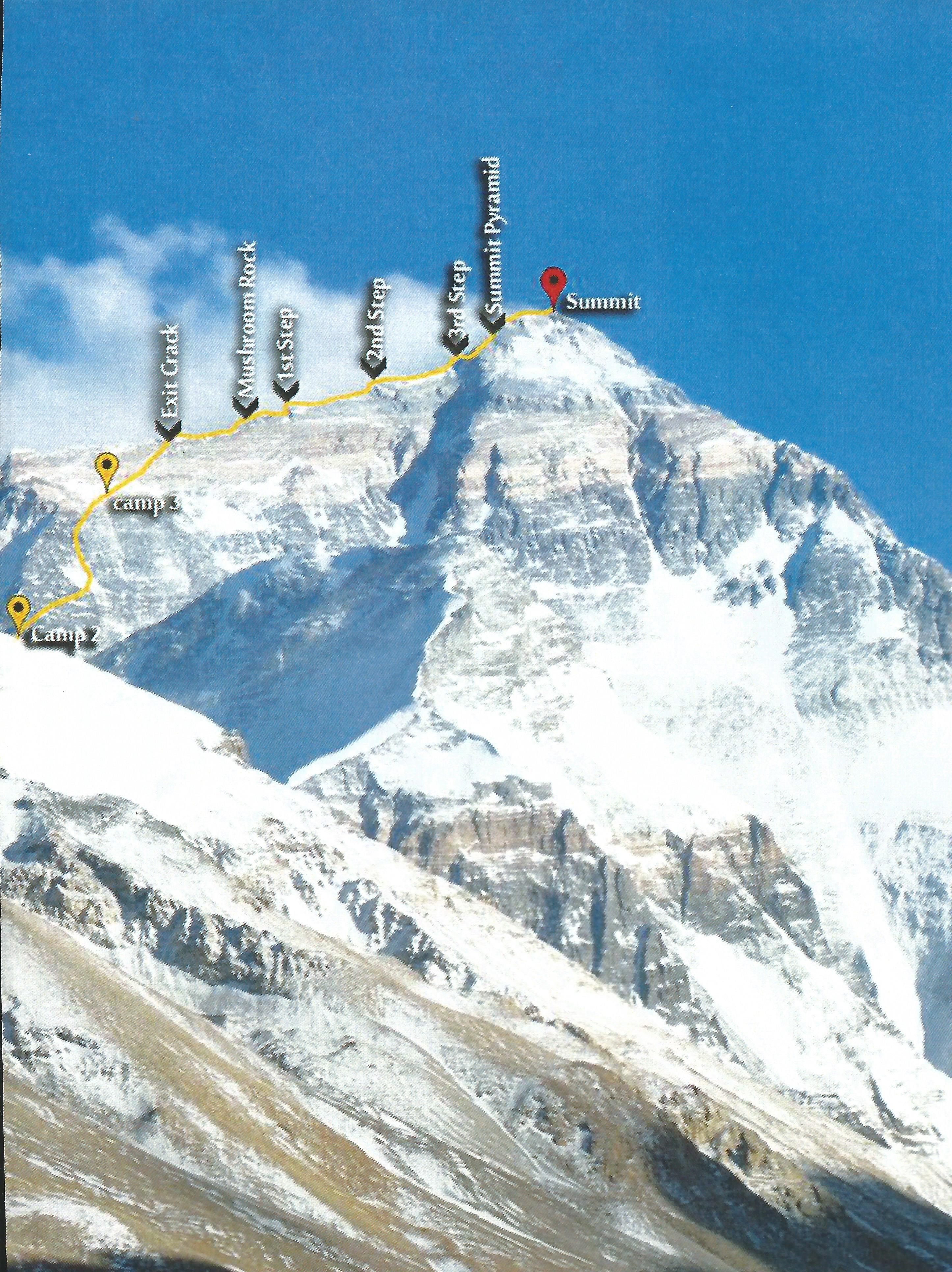
Our Expedition begins by driving towards the Nepalese-Tibetan border up to the Friendship Bridge. We will take time to acclimatise with a night at Zhangmu (2300 m) and couple nights at Nyalam (3750 m). Then we will proceed to Tingri (4350 m) where we will spend a couple of nights for better acclimatisation again. Then we hope to go to Everest Base Camp (EBC, at 5250 m) also called the ‘Chinese Base Camp’, and then we will trod the footsteps of George Mallory.
In general, there are no good recent maps of the Everest region. The German Arbeitsgemeinschaft für vergleichende Hochgebirgsforschung constructed maps of the region in the period 1955-1963 and issued their first series of 1:50,000 maps in 1965, which was updated in 1999. These maps are relatively detailed for the Nepalese side, but rather global for the Tibetan side. Based on the same dataset, the Östereichiser Alpenverein (Austrian Alpine Society) constructed a highly detailed 1:25,000 map which was issued in 1999. This map, however, mainly covers the Nepal side and only a very minor portion of the Northern route (roughly south of the North Col, or Chang La). There are no detailed maps available of the most northern area with the location of EBC.
In the map below (the 1:50,000 map) the route we intend to take from EBC is depicted. The route can also virtually be followed in 3D in a short video.
The route up to Advanced Base Camp (ABC, at ~ 6450 m) is pretty straight forward.
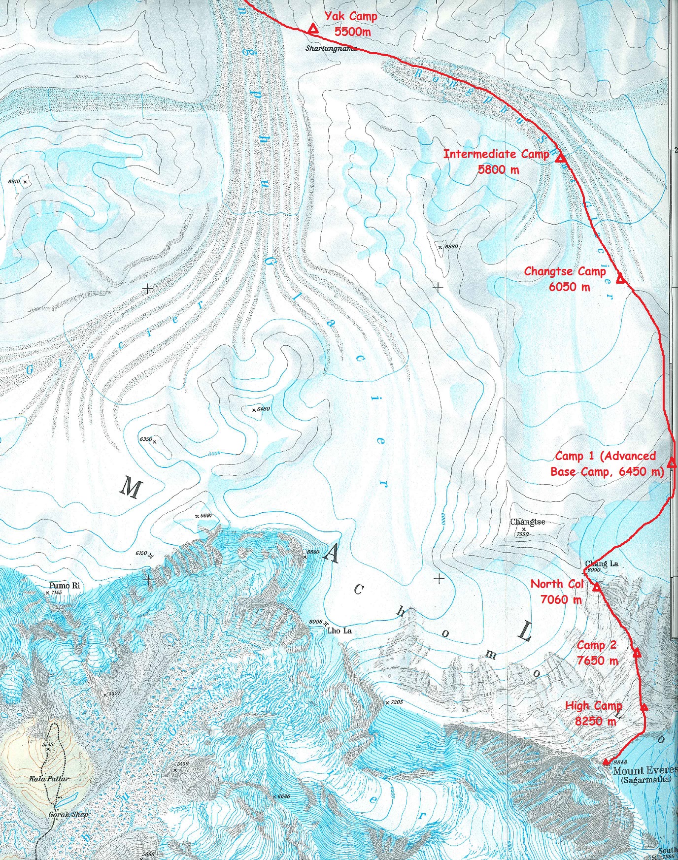
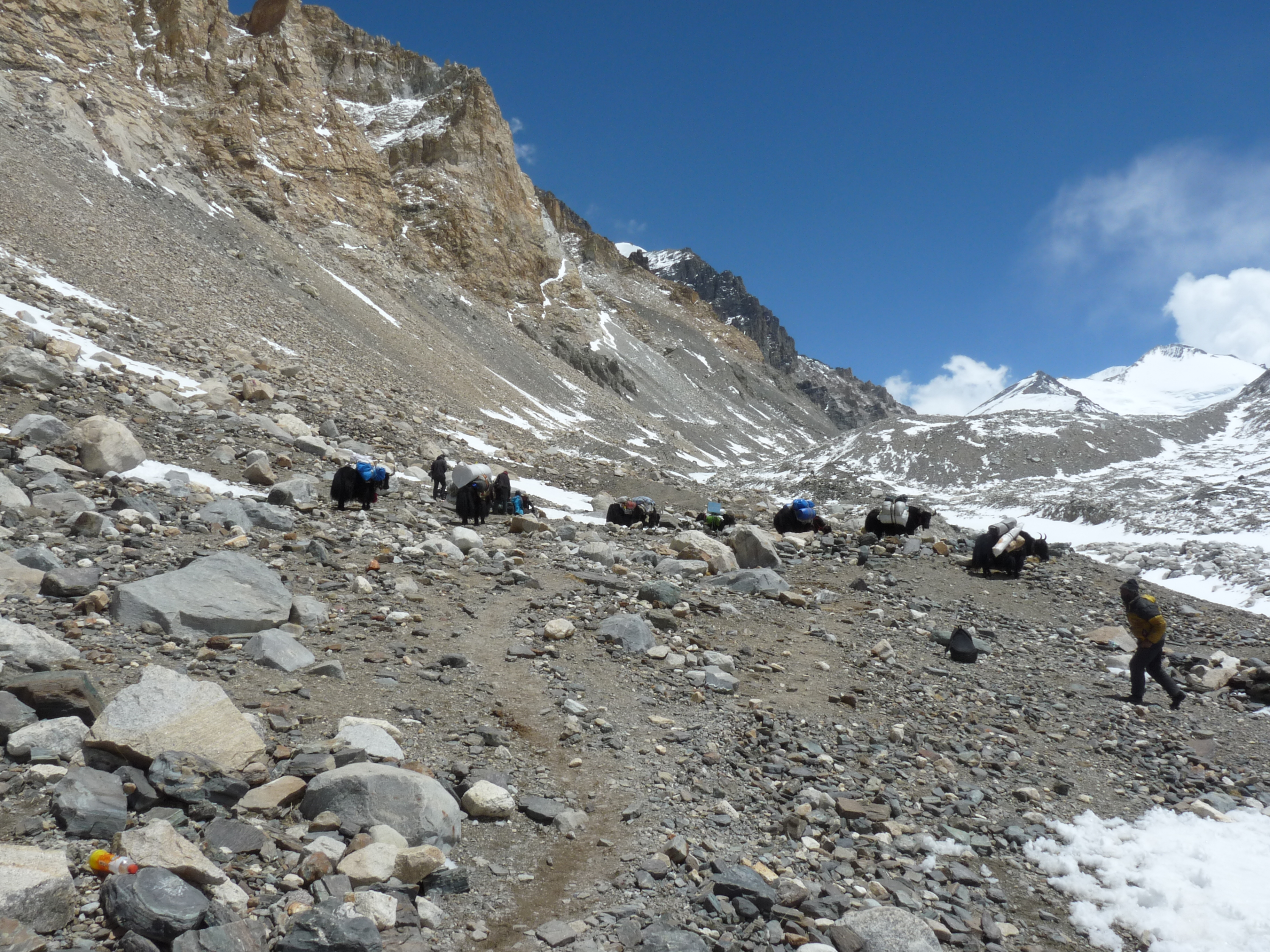
We will climb via the Rongbuk Glacier to Yak Camp (~5500 m) and then via Intermediate Camp (~5800 m) where we will stay to acclimatise, to Advanced Base Camp (ABC) at ~ 6450 m.
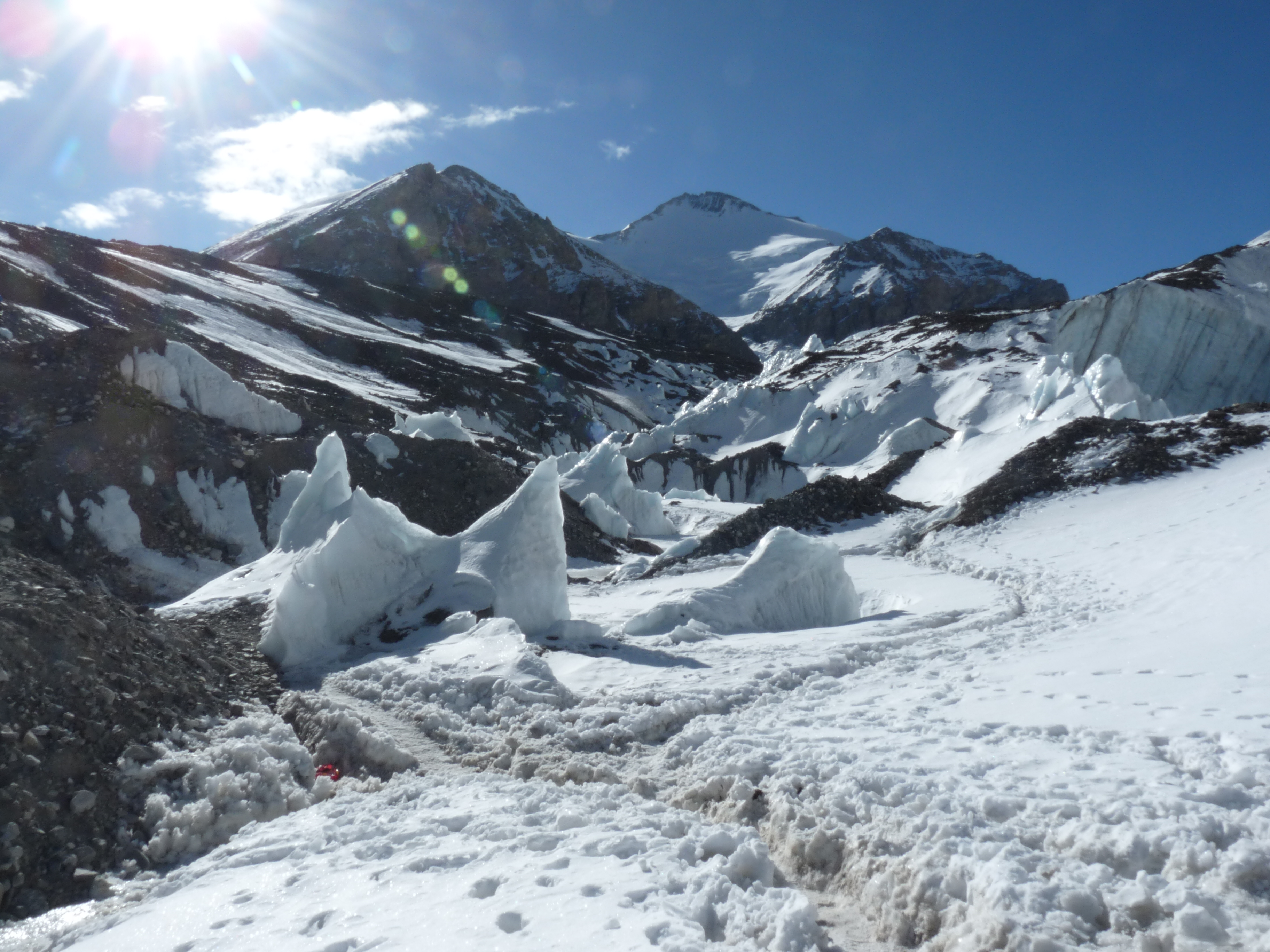
From ABC we’ll ascend over the glacier to the North Col (Chang La) at 7010 m, where Camp 1 will be built.
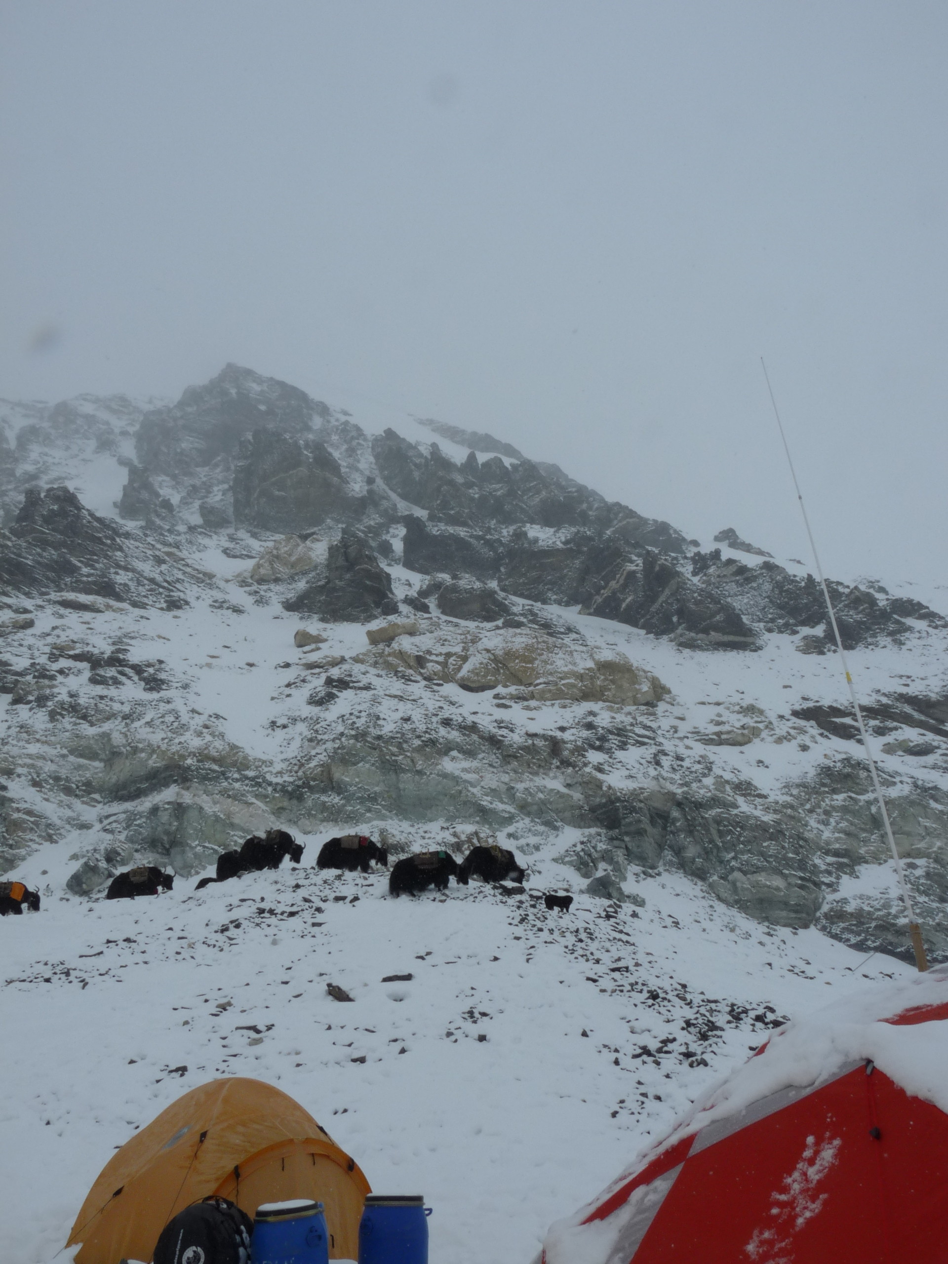
Then we’ll ascend the rocky north ridge to set up Camp II. There is a long reasonably angled snow slope to 7,500m where sometimes put Camp II can be build on a snow ledge. Depending on the conditions Camp II can be build further on, up a series of rock and gravel steps at 7,775m. Between these 2 camps, it is usually extremely windy, like in High Camp of the Southeastern route. The route continues from Camp II to High Camp (Camp III) crossing the North Face in a diagonal climb to the base of the Yellow Band. High Camp is normally on rock at ~ 8230 m, but may be snow-covered. From High Camp, we will make our final summit push.
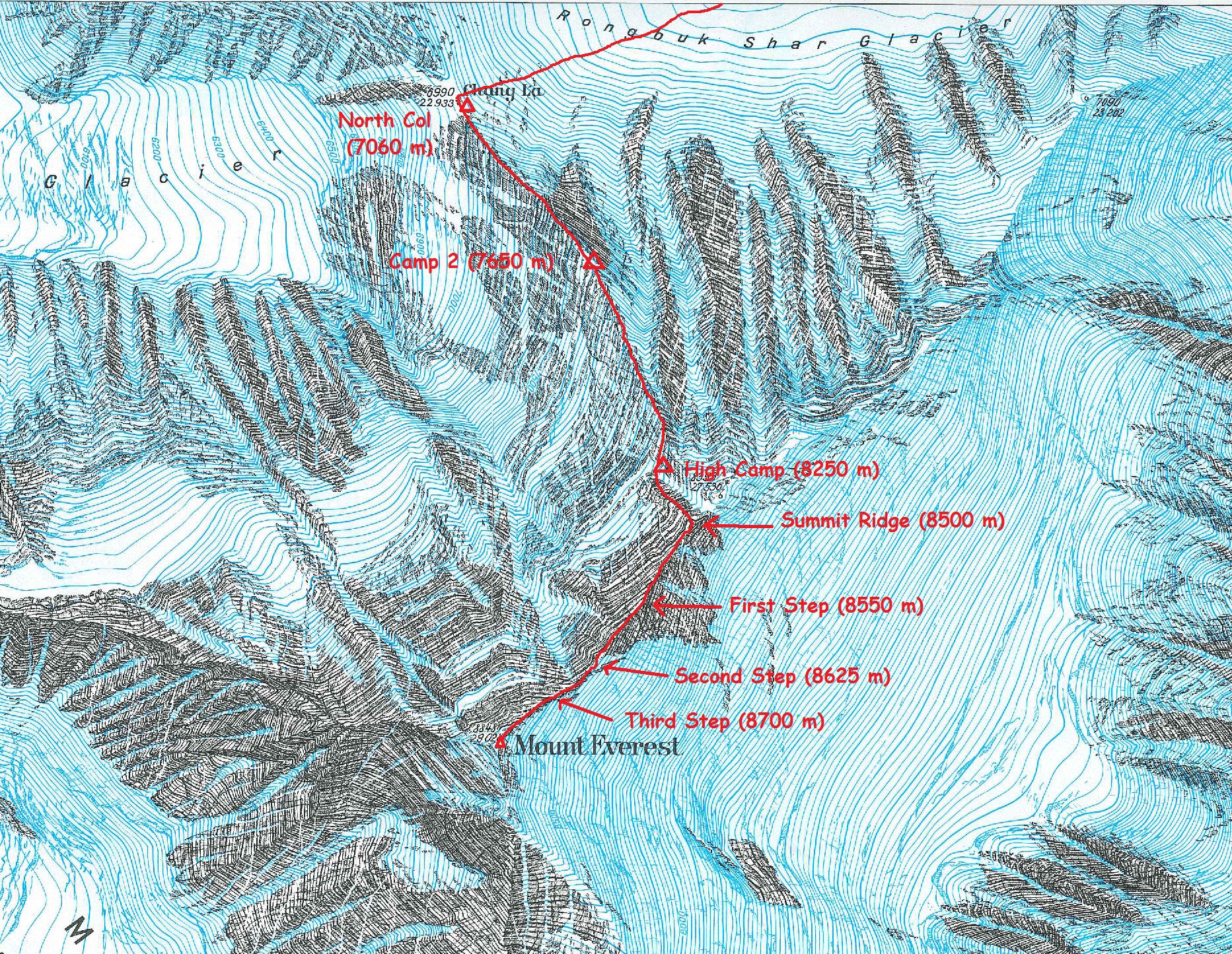
At the summit day, we will face the treacherous traverse from the base of the First Step; ascending from 8,501 metres (27,890 ft) to 8,534 m (28,000 ft), to the crux of the climb, the Second Step: ascending from 8,577 metres (28,140 ft) to 8,626 m (28,300 ft). Once above the Second Step the Third Step is clambered over: ascending from 8,690 m (28,510 ft) to 8,800 m (28,870 ft). Once above these steps, the summit pyramid is climbed via a snow slope of 50 degrees, to the final summit ridge along which at 8848 m the top of the world is reached.